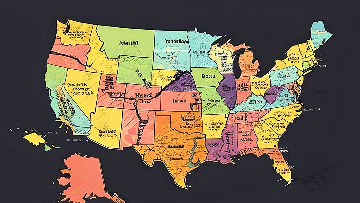
About This Quiz
This quiz is designed for geography enthusiasts who want to test their knowledge of all 50 U.S. states. With a higher level of difficulty, you'll need sharp eyes and a strong memory to correctly identify each state on the map.
To make things even trickier, we've randomly rotated each state's outline and removed some details. The rotated state outlines will test your ability to recognize states from unfamiliar perspectives, pushing your skills to the next level.
So, are you prepared to demonstrate your mastery and ace this Level 3 test? Good luck!

1. Which U.S. state is this map outline of?
[A] New Mexico | New Mexico has a distinctive square shape with slightly irregular edges. It is notably compact with a straight northern border and a slightly indented southern border, characterized by the notable presence of the "bootheel" in the southwest corner, which is a small protrusion downward.

2. Which U.S. state is this map outline of?
[C] Minnesota | Minnesota has a unique outline that includes a distinct, irregular northern border shaped by the "Arrowhead" region jutting northeast. The state has a relatively broad upper half that narrows slightly toward the south. The western border is primarily straight, while the eastern side features a combination of straight lines and jagged edges formed by natural features like rivers and lakes.

3. Which U.S. state is this map outline of?
[B] Michigan | Michigan has a highly distinctive outline characterized by its two separate landmasses: the Upper Peninsula and the Lower Peninsula, separated by water. The Lower Peninsula is often described as being mitten-shaped, with a rounded lower part and a thumb-like extension on the east. The Upper Peninsula is more irregular, with a jagged northern shoreline along Lake Superior and a narrow, elongated shape. The state’s unique shape is heavily influenced by the surrounding Great Lakes.

4. Which U.S. state is this map outline of?
[A] Mississippi | Mississippi has a distinctive outline characterized by its elongated, vertical shape with a relatively straight eastern border. The western border is defined by the Mississippi River, creating a series of curves and indents along that side. The northern and southern borders are mostly straight, with the southern edge dipping slightly into the Gulf of Mexico. The state’s shape is narrow and somewhat rectangular, with the western side being more irregular due to the river.

5. Which U.S. state is this map outline of?
[B] Massachusetts | Massachusetts has a distinctive outline characterized by its elongated shape that extends eastward into the Atlantic Ocean, forming a prominent "arm" known as Cape Cod. The western part of the state is more rectangular, while the eastern part, including Cape Cod, curves northward, giving the state a hook-like appearance. The southern border is relatively straight, with slight indents, while the northern border is more irregular.

6. Which U.S. state is this map outline of?
[D] South Carolina | South Carolina has a distinctive triangular outline with a broader base on the north and a tapering point toward the southeast. The state's eastern border is defined by a curved coastline along the Atlantic Ocean, while the northern border with North Carolina is relatively straight. The western border is slightly more irregular, with a mix of straight and gently curving lines. The overall shape is compact with a prominent southeastern tip extending into the ocean.

7. Which U.S. state is this map outline of?
[C] Rhode Island | Rhode Island has a distinctive outline characterized by its small, irregular shape with a somewhat jagged, indented coastline along the Atlantic Ocean. The state’s outline is compact and includes several small bays and peninsulas, giving it a somewhat irregular appearance. The western border is relatively straight, while the southern and eastern borders feature a mix of curves and indentations. Despite its small size, Rhode Island’s unique coastal shape makes it easily recognizable.

8. Which U.S. state is this map outline of?
[A] New Hampshire | New Hampshire has a distinctive outline characterized by its vertical shape with a notable "bump" along the western border where it juts slightly inward. The state has a relatively straight northern border with Canada, a mostly straight eastern border with Maine, and a more irregular southern border. The western side features a series of curves and indents, creating a somewhat asymmetric shape that is narrower at the top and widens toward the bottom.

9. Which U.S. state is this map outline of?
[B] Nevada | Nevada has a distinctive outline characterized by its rectangular shape with slightly irregular borders. The state is notably elongated horizontally, with a straight northern and southern edge. The western border is more irregular, following the natural contours of the land, while the eastern border is relatively straight. The shape of Nevada is notable for its overall rectangular appearance with some unevenness along the edges.

10. Which U.S. state is this map outline of?
[A] Nebraska | Nebraska has a distinctive outline characterized by its rectangular shape with straight borders. The state is notably elongated vertically, with a uniform width that gives it a clean, rectangular appearance. The northern and southern borders are straight and parallel, while the eastern and western borders are also straight, forming a nearly perfect rectangle. The state’s shape is straightforward and lacks significant irregularities.

11. Which U.S. state is this map outline of?
[C] Montana | Montana has a distinctive outline characterized by its large, rectangular shape with straight borders. The state is notably wide and tall, giving it a square-like appearance. The northern and southern borders are straight, while the eastern and western borders are also straight but with slightly uneven edges, particularly in the corners. The overall shape is expansive and simple, with few irregularities.

12. Which U.S. state is this map outline of?
[A] Missouri | Missouri has a distinctive outline characterized by its irregular, somewhat asymmetrical shape. The state features a combination of straight and curved borders, with a notable indentation on the southeastern side where it meets the Mississippi River. The northern border is relatively straight, while the western side has a more pronounced curve. The overall shape is somewhat amorphous, with a clear jutting out towards the southeast.

13. Which U.S. state is this map outline of?
[D] Oklahoma | Oklahoma has a distinctive outline characterized by its shape resembling a "panhandle" with a broad rectangular base and a narrow, extended "panhandle" on the west. The state is notably wide in the north and south, with a pronounced extension on the west side. The borders are relatively straight, with the eastern border slightly irregular due to natural features.

14. Which U.S. state is this map outline of?
[B] Ohio | Ohio has a distinctive outline characterized by its roughly rectangular shape with a slight irregularity on the eastern side. The state is relatively compact with a straight northern border along Lake Erie and a generally straight southern border. The eastern side features a notable indentation near the southeastern corner, giving the state a somewhat uneven edge compared to the other borders.

15. Which U.S. state is this map outline of?
[C] New Jersey | New Jersey has a distinctive outline characterized by its narrow, elongated shape with a pronounced bulge on the southeastern side where it meets the Atlantic Ocean. The state is notably narrow in the north and widens toward the south, with a jagged coastline and a series of bays and peninsulas. The overall shape is somewhat irregular, with the notable expansion in the southeast.

16. Which U.S. state is this map outline of?
[D] Maryland | Maryland has a distinctive outline characterized by its irregular shape with a prominent, jagged coastline along the Chesapeake Bay. The state features a broad, rectangular northern and western border, while the eastern side includes a noticeable indentation along the bay, creating a distinctive, almost triangular projection into the water. The southern border is also irregular, particularly around the Chesapeake Bay area.

17. Which U.S. state is this map outline of?
[C] Connecticut | Connecticut has a distinctive outline characterized by its relatively small, irregular shape. The state has a somewhat vertical rectangular form with a slight bulge on the western side and a noticeable indentation along the southern border where it meets Long Island Sound. The northern and southern borders are more irregular compared to the generally straight eastern and western borders.

18. Which U.S. state is this map outline of?
[A] Colorado | Colorado has a distinctive outline characterized by its almost perfect rectangular shape. The state features straight borders on all sides, creating a nearly square or rectangular appearance. The most notable feature is its uniformity in shape, with very little irregularity or indentation, and a generally straight northern and southern border, as well as eastern and western borders.

19. Which U.S. state is this map outline of?
[D] California | California has a distinctive outline characterized by its long, narrow shape with a jagged western coastline along the Pacific Ocean. The state’s shape is elongated vertically, with a notably irregular border on the west due to the coastline’s various bays and peninsulas. The eastern border is relatively straight, while the northern and southern borders are also relatively straight but with some minor irregularities.

20. Which U.S. state is this map outline of?
[C] Maine | Maine has a distinctive outline characterized by its irregular, somewhat jagged shape, with a prominent projection to the east along the Atlantic Ocean. The state features a broad and slightly curved southern border, while the northern and western borders are more irregular and uneven. The eastern side of Maine has a notable bulge into the ocean, creating a unique, non-uniform shape.

21. Which U.S. state is this map outline of?
[B] Louisiana | Louisiana has a distinctive outline characterized by its irregular, boot-like shape with a notable projection along the southeastern edge. The state’s outline features a narrow, elongated upper section that widens toward the south. The western border is more irregular and follows the Mississippi River, creating a unique curve. The shape of Louisiana is further defined by its various water bodies, including the delta region.

22. Which U.S. state is this map outline of?
[D] Kentucky | Kentucky has a distinctive outline characterized by its irregular, somewhat diamond-shaped form. The state features a notable indentation along the northern border, where it meets the Ohio River, and a prominent protrusion on the western side. The southern border is also somewhat irregular, with a mix of straight and curved lines, giving the state a unique, non-uniform shape.

23. Which U.S. state is this map outline of?
[C] North Dakota | North Dakota has a distinctive outline characterized by its rectangular shape with relatively straight borders. The state features a tall, narrow form, with a straight northern border and a slightly curved southern border. The eastern and western borders are mostly straight, giving the state a clean, rectangular appearance with minimal irregularities.

24. Which U.S. state is this map outline of?
[A] North Carolina | North Carolina has a distinctive outline characterized by its elongated shape with a noticeable projection along the eastern coast. The state features a relatively straight southern border, with a prominent, slightly irregular coastline along the Atlantic Ocean. The northern and western borders are straighter, while the eastern border has a mix of curves and indentations, creating a unique shape that extends into the ocean.

25. Which U.S. state is this map outline of?
[B] New York | New York has a distinctive outline characterized by its irregular shape with a notable projection along the eastern side where it meets Vermont and Massachusetts. The state features a long, narrow northern border along the Great Lakes and a jagged coastline along the Atlantic Ocean. The western and southern borders are also somewhat irregular, creating a unique shape that includes a prominent extension into the Great Lakes region.

26. Which U.S. state is this map outline of?
[B] Kansas | Kansas has a distinctive outline characterized by its nearly rectangular shape with straight borders. The state is notably elongated horizontally, with straight northern and southern borders. The eastern and western borders are also straight, creating a uniform, rectangular appearance. The simplicity and regularity of Kansas’s shape make it easily recognizable.

27. Which U.S. state is this map outline of?
[C] Iowa | Iowa has a distinctive outline characterized by its rectangular shape with slightly irregular borders. The state is notably wide in the central part, tapering slightly toward the north and south. The eastern and western borders are relatively straight, but the southern border has a slight curve, giving Iowa a somewhat asymmetrical rectangular shape.

28. Which U.S. state is this map outline of?
[D] Hawaii | Hawaii has a distinctive outline characterized by its series of islands with a unique, scattered shape. The state is made up of several islands spread across the central Pacific Ocean. The overall shape is irregular and non-contiguous, with no straight borders, and is defined by the distinct outlines of its individual islands, including the large island of Hawaii and the smaller islands of the Hawaiian archipelago.

29. Which U.S. state is this map outline of?
[A] Georgia | Georgia has a distinctive outline characterized by its irregular shape with a noticeable bump on the southeastern side where it extends into the Atlantic Ocean. The state features a relatively straight northern border and a curving southern border along the coast. The western border has a series of curves and straight segments, giving Georgia a somewhat asymmetrical, yet recognizable shape.

30. Which U.S. state is this map outline of?
[D] Florida | Florida has a distinctive outline characterized by its long, narrow shape that extends into the Atlantic Ocean and the Gulf of Mexico. The state features a prominent, jutting peninsula with a relatively straight western border and an irregular coastline along the eastern and southern edges. The overall shape is elongated with a notable protrusion southward, creating a unique, recognizable profile.

31. Which U.S. state is this map outline of?
[D] Indiana | Indiana has a distinctive outline characterized by its roughly rectangular shape with a noticeable notch in the southwestern corner. The state is mostly rectangular with straight borders, but the southwestern edge has a pronounced indentation, giving Indiana its unique shape. The northern border is straight and parallel to the southern border, while the eastern and western borders are also relatively straight but with the irregular notch on the southwest.

32. Which U.S. state is this map outline of?
[A] Illinois | Illinois has a distinctive outline characterized by its relatively straight, rectangular shape. The state is long and narrow vertically, with a uniform width. The northern and southern borders are straight and parallel, while the eastern and western borders are also straight, creating a clean rectangular appearance. The state’s outline is simple and consistent, with minimal irregularities.

33. Which U.S. state is this map outline of?
[D] Idaho | Idaho has a distinctive outline characterized by its irregular shape with a notable vertical extension. The state has a narrow, elongated form with a prominent jutting area on the western side where it curves inward. The eastern and western borders are more irregular compared to the relatively straight northern and southern borders. The shape of Idaho is unique due to its extended vertical profile and uneven edges.

34. Which U.S. state is this map outline of?
[B] Delaware | Delaware has a distinctive outline characterized by its narrow, elongated shape with a slight bulge on the western side. The state is one of the smallest in the U.S., with a long, thin form that stretches from the Delaware River on the west to the Atlantic Ocean on the east. The southern border is slightly curved, and the overall shape is somewhat irregular with a noticeable protrusion.

35. Which U.S. state is this map outline of?
[D] Arkansas | Arkansas has a distinctive outline characterized by its rectangular shape with a notable protrusion in the southeast. The state features a relatively straight northern and southern border, with a more irregular western border that follows the Mississippi River. The southeastern corner has a noticeable extension, giving Arkansas its unique shape. The state’s overall form is predominantly rectangular with some irregularities along the borders.

36. Which U.S. state is this map outline of?
[C] Arizona | Arizona has a distinctive outline characterized by its almost rectangular shape with a notable extension in the northeastern corner. The state features straight borders on the north, south, and west, with a slight irregularity on the eastern side. The northeastern extension creates a unique notch that sets Arizona apart from neighboring states. The overall shape is predominantly rectangular with some unevenness along the edges.

37. Which U.S. state is this map outline of?
[D] Alaska | Alaska has a distinctive outline characterized by its large, irregular shape with several prominent peninsulas and islands. The state features a vast and rugged coastline with numerous inlets and bays, particularly on the southern and western sides. The northern border is also irregular due to its proximity to the Arctic Ocean, and the overall shape is complex and jagged compared to other states.

38. Which U.S. state is this map outline of?
[B] Alabama | Alabama has a distinctive outline characterized by its elongated rectangular shape with a notable curve along the eastern side. The state features a relatively straight northern border and a curving southern border along the Gulf of Mexico. The western border is also straight, while the eastern side has a prominent inward curve, giving Alabama its unique shape.

39. Which U.S. state is this map outline of?
[D] Wyoming | Wyoming has a distinctive outline characterized by its nearly rectangular shape with straight borders. The state features a uniform, rectangular form with straight lines along the northern, southern, eastern, and western edges. Wyoming’s shape is very symmetrical and regular, with few irregularities, making it stand out as a nearly perfect rectangle.

40. Which U.S. state is this map outline of?
[A] Wisconsin | Wisconsin has a distinctive outline characterized by its irregular shape with a notable projection into Lake Michigan. The state features a relatively straight northern border and a more irregular southern border, with a pronounced eastern projection along the lakeshore. The western side of the state also has a noticeable indentation where it meets the Mississippi River, giving Wisconsin its unique shape.

41. Which U.S. state is this map outline of?
[B] Virginia | Virginia has a distinctive outline characterized by its irregular shape with a notable projection in the southeastern part. The state features a relatively straight northern border and a curving southern border along the North Carolina border. The western side is also irregular, with a series of curves and indentations. The overall shape is somewhat asymmetrical with a prominent eastern bulge.

42. Which U.S. state is this map outline of?
[A] Vermont | Vermont has a distinctive outline characterized by its vertical, rectangular shape with a slight irregularity along the western border. The state is notably narrow and elongated, with a straight northern border and a generally straight southern border. The western side features a subtle curve where it meets New York, while the eastern side is relatively straight.

43. Which U.S. state is this map outline of?
[C] West Virginia | West Virginia has a distinctive outline characterized by its irregular shape with a series of protrusions and indentations along the borders. The state features a notable projection along the southwestern corner and a series of curves and angles on the northern and eastern sides. The overall shape is somewhat complex and asymmetrical compared to its neighboring states.

44. Which U.S. state is this map outline of?
[D] Washington | Washington has a distinctive outline characterized by its irregular shape with a prominent, jagged coastline along the Pacific Ocean. The state features a relatively straight northern border with Canada and a more irregular western border with numerous bays and inlets. The eastern side is straighter, creating a unique and varied outline.

45. Which U.S. state is this map outline of?
[B] Utah | Utah has a distinctive outline characterized by its rectangular shape with slightly uneven borders. The state is compact and horizontally elongated, with a generally straight northern and southern edge and slightly irregular eastern and western edges. The shape of Utah is notably symmetrical but with minor irregularities along the edges.

46. Which U.S. state is this map outline of?
[C] Texas | Texas has a distinctive outline characterized by its large, irregular shape with several prominent protrusions. The state features a notable extension on the northern border, a pronounced projection on the western side, and a unique, jagged coastline along the Gulf of Mexico. The overall shape is asymmetrical with a broad, irregular outline that sets Texas apart from other states.

47. Which U.S. state is this map outline of?
[B] Tennessee | Tennessee has a distinctive outline characterized by its long, narrow rectangular shape with a notable horizontal stretch. The state features a relatively straight northern and southern border, with a width that is much longer than it is tall. The eastern and western borders are also straight, giving Tennessee a well-defined, elongated rectangular form.

48. Which U.S. state is this map outline of?
[A] Pennsylvania | Pennsylvania has a distinctive outline characterized by its rectangular shape with a notable notch in the northwestern corner. The state features relatively straight borders on the north and south, with the western border having a slight indentation due to natural features. The eastern side is more regular, creating a mostly rectangular form with a minor irregularity in the northwest.

49. Which U.S. state is this map outline of?
[D] Oregon | Oregon has a distinctive outline characterized by its irregular shape with a notable vertical division. The state features a rugged coastline along the Pacific Ocean, with numerous bays and peninsulas. The eastern border is relatively straight but with slight variations, while the northern and southern borders are more irregular. The overall shape is asymmetrical with a pronounced coastal outline.

50. Which U.S. state is this map outline of?
[C] South Dakota | South Dakota has a distinctive outline characterized by its rectangular shape with a notable horizontal extension. The state features straight northern and southern borders, with a relatively uniform width. The eastern and western borders are also straight, creating a clean, rectangular appearance. The shape is straightforward and less irregular compared to neighboring states.
Your Scorecard
50 U.S. States Map Quiz (Hard, L3)
- Correct
- Correct Rate%Avg Correct Rate
- L3Difficulty Level3xPoints
- Get Points
- Perfect100%
- Excellent≥90%
- Very Good≥80%
- Good≥70%
- Passed≥60%
- Failed≤50%
- 50 U.S. States Map Quiz (Easy, L1)
- 50 U.S. States Map Quiz (Medium, L2)
- 50 U.S. States Map Quiz (Hard, L3)
Recent Top Players
Related Quizzes
-
![]()
195 Countries Map Outlines Quiz (4)
45 QuestionsPlay Quiz -
![]()
195 Countries Map Outlines Quiz (3)
50 QuestionsPlay Quiz -
![]()
195 Countries Map Outlines Quiz (2)
50 QuestionsPlay Quiz -
![]()
195 Countries Map Outlines Quiz (1)
50 QuestionsPlay Quiz -
![]()
Guess 50 U.S. States from Scrambled Names
50 QuestionsPlay Quiz -
![]()
Guess 50 U.S. States from Emojis (2)
50 QuestionsPlay Quiz -
![]()
Guess 50 U.S. States from Emojis (1)
50 QuestionsPlay Quiz -
![]()
50 U.S. States Flags Quiz (by A-Z)
50 QuestionsPlay Quiz


More from QuizABCD
-
![]()
100 Fun Number Riddles Quiz (L3,1)
30 QuestionsPlay Quiz -
![]()
Identify 100 K-pop Groups Quiz (3)
40 QuestionsPlay Quiz -
![]()
Michael Jackson: 60 Fun Trivia Questions (2)
30 QuestionsPlay Quiz -
![]()
45 Fun Vocabulary Quiz: UK vs. USA
45 QuestionsPlay Quiz -
![]()
50 U.S. States Map Quiz (Hard, L3)
50 QuestionsPlay Quiz -
![]()
Identify 100 Greatest Music Artists Quiz (3)
40 QuestionsPlay Quiz -
![]()
100 Easy Astronomy Questions Quiz (3)
40 QuestionsPlay Quiz -
![]()
Identify 100 Greatest Directors Quiz (2)
30 QuestionsPlay Quiz


Trending Quizzes
This week-
![]()
50 U.S. States Map Quiz (Easy, L1)
000,000 Plays / 0,000 LikesPlay Quiz -
![]()
50 U.S. State Flags Quiz (Easy, L1)
000,000 Plays / 0,000 LikesPlay Quiz -
![]()
Guess 50 U.S. States from Emojis (1)
000,000 Plays / 0,000 LikesPlay Quiz -
![]()
32 NFL Team Logos Quiz (1)
000,000 Plays / 0,000 LikesPlay Quiz -
![]()
30 NBA Team Logos Quiz (1)
000,000 Plays / 0,000 LikesPlay Quiz -
![]()
Spot the Differences: Test Your Keen Eye!
000,000 Plays / 0,000 LikesPlay Quiz -
![]()
Identify 100 Greatest Music Artists Quiz (1)
000,000 Plays / 0,000 LikesPlay Quiz -
![]()
50 Greatest TV Characters Quiz
000,000 Plays / 0,000 LikesPlay Quiz -
![]()
U.S. Presidents Quiz: by Timeline
000,000 Plays / 0,000 LikesPlay Quiz -
![]()
30 Common Chat Acronyms Quiz
000,000 Plays / 0,000 LikesPlay Quiz